How digital technology is redrawing the map of urban planning
Posted on: 14 November, 2025

By Linda Serck
Digital technology is now one of the core tools shaping how cities understand risk, prioritise investment and design for long-term resilience.
Professor Samer Bagaeen, Head of Town Planning at our university, argues that the sector has reached a point where planners, policymakers and investors must treat digital capability as a baseline rather than a luxury.
His perspective below offers a practical lens on how digital technology and data analytics can support more adaptive, evidence-based city planning.
Understanding resilience in a digital planning era
Resilience is often framed in terms of climate impacts, but Professor Bagaeen takes a broader view. He said: “Urban resilience today means a city’s ability to anticipate, absorb, and recover from shocks – be they climate, economic, or social – while continuing to thrive.”
This definition places data at the centre of urban management. Cities can only anticipate and absorb shocks if they have a clear, real-time understanding of how their systems behave – from transport and drainage to energy networks and land use patterns.
Research supports this shift. A recent study on smart city planning notes that technologies such as big-data analytics, IoT sensors and AI are already assisting resilience planning across several countries, particularly in transport and environmental management (MDPI, 2025).
Nature as infrastructure
 Professor Bagaeen also emphasises the growing role of nature as infrastructure, something digital tools help quantify:
“Nature-based solutions – such as green corridors, urban wetlands, and permeable landscapes – act as buffers against floods, heatwaves and pollution.
“Integrating these into city planning not only makes urban environments more resilient but also unlocks new investment opportunities.”
Digital modelling allows planners to test these interventions, compare their performance with grey infrastructure and present evidence to decision-makers.
Where digital technology is reshaping planning practice
For Professor Bagaeen, the strength of plantech – the use of digital tools, data and technology (GIS, digital twins and AI) – lies in its ability to improve foresight and transparency:
“Digital technology and data analytics are pivotal – they enable cities to monitor risks in real time, simulate future scenarios, and make data-driven decisions.”
Several areas stand out:
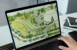
- Digital mapping and scenario modelling
Planners can now map risk exposure at a granular scale, modelling how flooding, heat, population growth or infrastructure failure ripple across a city. This supports earlier, more targeted interventions.
- Participatory digital platforms
Online engagement tools allow communities to interact with planning proposals and give feedback that can be visualised in real time.
- Digital twins
Digital twins – virtual replicas of physical urban systems – are emerging as one of the sector’s most influential tools. A 2025 study notes their use in testing impacts of climate scenarios, infrastructure upgrades and land-use changes (Cogitatio, 2025).
Professor Bagaeen explains their value for investment decision-making:
“Digital twins of cities can demonstrate the cost-effectiveness of green infrastructure, making it easier for financiers to invest in sustainable urban assets with confidence.”
Making resilience investable: the importance of data
 One of the clearest shifts in recent years has been the link between digital data and the flow of capital. Investors increasingly expect measurable evidence of climate adaptation and risk management.
Professor Bagaeen points to the importance of MRV – Measurement, Reporting and Verification:
“MRV helps investors and insurers quantify risk exposure, track the performance of resilience interventions … and price capital more accurately for adaptation projects.”
Simply put, data builds credibility. It helps planners justify costs, helps cities compete for funding and reassures insurers and financiers that adaptation is measurable rather than speculative.
A report by Reuters (2024) notes that digital twin technologies alone could deliver hundreds of billions of dollars in avoided losses globally by 2030 – a scale of economic benefit that is hard to ignore.
Persistent barriers and how cities are moving past them
Digital planning is not without its obstacles. Governance fragmentation, inconsistent data standards and budget constraints frequently stall progress. Professor Bagaeen acknowledges this:
“Barriers … such as fragmented governance or limited budgets … are being overcome by demonstrating the economic value of resilience – quantifying avoided costs and improved asset performance.”
Evidence from the UK and internationally shows that successful cities tend to:
- Invest in open data ecosystems.
- Align climate, housing and infrastructure policies.
- Embed digital skills across planning departments.
- Combine nature-based and technological solutions.
- Build coalitions between planners, engineers, finance teams and communities.
A sector at a turning point
With AI replacing job roles remaining an ongoing fear, it is important to note that digital tools are not replacing planners; they are strengthening the strategic core of planning practice.
Professor Bagaeen’s work illustrates a sector moving towards a more integrated model where digital mapping, analytics, financial modelling and community feedback sit side by side.
His message is straightforward: Digital capability is now central to planning resilient, investable urban places.
Cities that adopt these tools early will have a significant advantage – not only in responding to shocks, but in attracting the investment and public trust required to build sustainable futures.
The MSc Urban Planning at the University of the Built Environment’s School of Town Planning – led by Professor Samer Bagaeen – equips students with the skills, insight and digital literacy needed to shape the cities of tomorrow.
Drawing on Samer’s expertise in resilience, plantech and sustainable finance, the programme blends rigorous academic grounding with real-world application, from spatial strategy and policy design to data-driven planning and digital modelling.
View the course brochure and register your interest.


